
News Summary
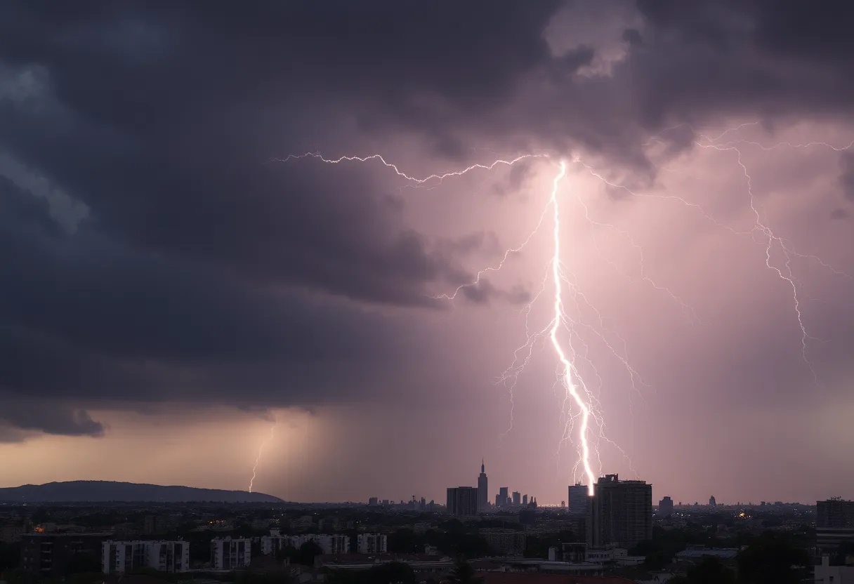
A Severe Thunderstorm Watch is in effect for several counties in southeast Texas until 10 p.m. today, with thunderstorms expected to bring hail and damaging winds. Residents are urged to stay vigilant and monitor weather updates as risks for severe storms spread throughout the week, impacting millions across multiple states. The potential for hazardous conditions, including high winds and lightning, has prompted recommendations for safety measures while warning of possible disruptions ahead, particularly as the Atlantic Hurricane Season approaches.
Houston, Texas – A Severe Thunderstorm Watch is currently in effect for several counties in southeast Texas until 10 p.m. on Sunday, June 1, 2025. The counties affected by this advisory include Harris, Fort Bend, Montgomery, Liberty, Waller, and San Jacinto.
In addition, a Severe Thunderstorm Warning is already in effect for certain regions until 5 p.m. localized to the northern areas of Houston. Meteorologists are predicting significant storm activity, including the possibility of tennis-ball-sized hail and wind gusts reaching speeds of up to 70 mph. The potential for these hazardous conditions has prompted the Storm Prediction Center to classify southeast Texas under a Level 1 and/or 2 risk on a scale of 5 for severe thunderstorms, with the highest risk situated to the north of the region.
The severe thunderstorm activity is characterized by the likelihood of hail, gusty winds, and frequent lightning. Individuals in the affected areas are urged to remain vigilant and monitor updates to the weather forecast as the storms develop.
Recent storm tracking has revealed that a significant system is approaching the northern Houston area. A Thunderstorm Watch indicates that storms may occur in the immediate future and residents are advised to stay informed of changing conditions. Meanwhile, a Thunderstorm Warning signifies that storms are actively impacting specific locations, and individuals should take appropriate safety measures, including seeking shelter when necessary.
Accompanying the threat of severe thunderstorms, there is also an air quality alert due to elevated ozone levels in the region. This alert remains in effect through the evening hours, advising people, specifically those with respiratory issues, to limit outdoor activities.
The weather forecast for the first week of June suggests typical summer conditions, including temperatures ranging from the low to middle 90s, with potential heat index values soaring near 100 degrees. In addition to thunderstorms, there are expectations of scattered showers and storms throughout the week, with some weather systems anticipated to reach strong to severe levels.
Consequently, the severe weather threat extends over multiple days, affecting millions of people from the Plains to the Upper Midwest. Residents are encouraged to remain aware of the ongoing weather risks and to prepare for changing conditions throughout the week.
In an unfortunate incident related to thunderstorm activity, a lightning strike in Lake Benbrook resulted in injuries to two individuals seeking shelter under a canopy at Mustang Park on the same day, highlighting the dangers posed by thunderstorms and lightning.
Furthermore, as the Atlantic Hurricane Season approaches, predictions indicate there could be between 13 to 19 named storms, including an estimated 6 to 10 hurricanes and 3 to 5 major hurricanes within the season. This prospect necessitates ongoing vigilance from residents as they prepare for any possible hurricane threats.
Residents in southeast Texas are advised to stay informed regarding severe weather warnings and advisories, prepare for potential disruptions, and ensure they have safety plans in place. As storm activity unfolds, updating one’s knowledge about the current weather situation can make a significant difference in personal safety and preparedness.
Deeper Dive: News & Info About This Topic
HERE Resources
Houston Bracing for Severe Weather as Cold Front Approaches
Severe Storms Cause Power Outages and Damages in Houston
Houston Faces Record Heat and Severe Storms Ahead
Houston Experiences Record-Breaking Heat and Humidity
Austin Faces Potentially Historic Heat Wave This Week
Severe Thunderstorms Cause Flash Flood Warning in Houston
Clear Skies and Mild Temperatures for Mother’s Day in Houston
Severe Weather System Impacts Houston Area
Severe Thunderstorms Expected in Southeast Texas
Tornado Watch Issued for Northern Houston Areas
Additional Resources
- Fox 26 Houston: Severe Thunderstorm Watch – June 1, 2025
- Houston Chronicle: Meteorological Summer Forecast
- KHOU: Houston Weather Forecast Impact
- Space City Weather: Friday Morning Rain and Thunder
- Wikipedia: Severe Thunderstorm
- Google Search: Texas Weather Alerts
- Encyclopedia Britannica: Thunderstorm
- Google News: Houston Weather June 2025

Author: STAFF HERE HOUSTON TX WRITER
The HOUSTON STAFF WRITER represents the experienced team at HEREHouston.com, your go-to source for actionable local news and information in Houston, Harris County, and beyond. Specializing in "news you can use," we cover essential topics like product reviews for personal and business needs, local business directories, politics, real estate trends, neighborhood insights, and state news affecting the area—with deep expertise drawn from years of dedicated reporting and strong community input, including local press releases and business updates. We deliver top reporting on high-value events such as Houston Livestock Show and Rodeo, Art Car Parade, and Chevron Houston Marathon. Our coverage extends to key organizations like the Greater Houston Partnership and Houston Area Urban League, plus leading businesses in energy and healthcare that power the local economy such as ExxonMobil, Schlumberger, and Houston Methodist. As part of the broader HERE network, including HEREAustinTX.com, HERECollegeStation.com, HEREDallas.com, and HERESanAntonio.com, we provide comprehensive, credible insights into Texas's dynamic landscape.