
News Summary
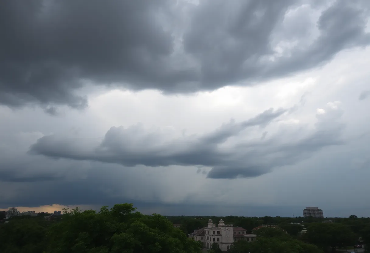
Southeast Texas, especially Houston, is preparing for scattered thunderstorms and flooding risks as a weak cold front approaches. With high humidity and temperatures reaching the upper 80s, the region faces significant rainfall potential, particularly north and west of Houston. Cities like Katy and College Station are under a Level 2 flood risk, while Houston is at Level 1. Rain is expected to increase through the afternoon, with total accumulations possibly exceeding 3 inches in isolated areas by Labor Day weekend.
Southeast Texas Braces for Scattered Thunderstorms and Flood Risks as Weak Cold Front Approaches
Southeast Texas, particularly the Houston area, is preparing for a cluster of storms expected to arrive by 1 p.m. on Sunday as a weak cold front moves slowly into the region. This system is forecasted to bring increased thunderstorm activity and a heightened risk of flooding, especially across various cities north and west of Houston.
As the cold front interacts with deep Gulf moisture, showers and thunderstorms are projected to become widely scattered. While temperatures on Sunday are expected to peak in the upper 80s to near 90 degrees, which is only a slight decrease from Saturday’s high of 91 to 93 degrees, the humidity is likely to remain high, contributing to the oppressively warm conditions.
Morning lows are expected to hover around 80 degrees under mostly cloudy skies. While rain chances are relatively low in the morning at approximately 30%, any storms that do develop could result in intense downpours, raising concerns for isolated flash flooding. As the cold front presses in from the northwest, the likelihood of rain is forecasted to increase significantly from 11 a.m. to 5 p.m., during which sporadic heavy rainfall may occur.
For those living in the surrounding regions, the flood risk is more pronounced. Areas such as Katy, The Woodlands, Conroe, Huntsville, and College Station are under a Level 2 of 4 risk for excessive rainfall, translating to a 15% chance of flash flooding within a 25-mile radius. In contrast, much of Houston is classified under a Level 1 of 4 risk, equating to a 5% chance of experiencing flash flooding.
As the sun sets, slightly drier air is expected to move into the area, which should reduce rain chances to about 20% to 30%. Evening temperatures are projected to cool into the upper 70s, offering some relief from the daytime heat.
Looking ahead to Labor Day Monday, widely scattered showers and thunderstorms are anticipated, particularly during the morning and early afternoon. Houston’s rain chances for that day are projected between 50% to 60%, indicating more intermittent rain rather than steady precipitation. Afternoon temperatures on Monday will be slightly below average, likely reaching the upper 80s.
Total rainfall from the storms over the coming days is expected to range from 1 to 1½ inches, with isolated areas potentially exceeding 3 inches. Weather experts from the National Weather Service have indicated that this slow-moving cold front could lead to locally heavy rainfall across the region during the Labor Day weekend.
Despite the impending rain, temperatures reached a peak of 91 to 93 degrees in Houston on Saturday under partly sunny skies before the onset of thunderstorms. Residents should remain vigilant as localized flooding and gusty winds are potential hazards associated with stronger storms.
The position of the cold front will ultimately determine how widely storms will develop, and a further southward movement could lead to drier conditions on Labor Day. As the season transitions into meteorological fall, residents can expect slightly less humid air with temperatures in the upper 80s to lower 90s. Longer-term forecasts suggest above-normal temperatures for much of the fall, though an increase in rain is possible by the end of the week.
Deeper Dive: News & Info About This Topic
HERE Resources
Houston Prepares for a Vibrant Labor Day Weekend
High School Football Season Begins in Houston Metro Area
Severe Turbulence Forces United Express Flight Diversion
Susquehanna Township Schools Cancel Classes Due to Bus Driver Shortage
Labor Day Weekend Celebrations in Houston
How to Choose the Best Shrubs for Your Houston Landscape to Beat the Heat
Klauer Manufacturing Company Expands to Tomball, Texas
Charleston High School Football Games Postponed Due to Rain
Houston Soccer Game Against Sam Houston State Canceled
Concerns Rise Over SEPTA Transportation Cuts in Philadelphia Schools
Additional Resources
- Houston Chronicle: Houston Flood Threat
- Wikipedia: Weather of Texas
- Beaumont Enterprise: Southeast Texas Cool Front Forecast
- Google Search: Southeast Texas weather
- Click2Houston: Strong Storms Lead to Flood Threat
- Encyclopedia Britannica: Climate of Texas
- Weather and Radar: Clear Water in Galveston
- Google News: Texas cold front

Author: STAFF HERE HOUSTON TX WRITER
The HOUSTON STAFF WRITER represents the experienced team at HEREHouston.com, your go-to source for actionable local news and information in Houston, Harris County, and beyond. Specializing in "news you can use," we cover essential topics like product reviews for personal and business needs, local business directories, politics, real estate trends, neighborhood insights, and state news affecting the area—with deep expertise drawn from years of dedicated reporting and strong community input, including local press releases and business updates. We deliver top reporting on high-value events such as Houston Livestock Show and Rodeo, Art Car Parade, and Chevron Houston Marathon. Our coverage extends to key organizations like the Greater Houston Partnership and Houston Area Urban League, plus leading businesses in energy and healthcare that power the local economy such as ExxonMobil, Schlumberger, and Houston Methodist. As part of the broader HERE network, including HEREAustinTX.com, HERECollegeStation.com, HEREDallas.com, and HERESanAntonio.com, we provide comprehensive, credible insights into Texas's dynamic landscape.