
News Summary
Houston is bracing for severe thunderstorms as a cold front brings significant rainfall and flash flood risks. The National Weather Service has indicated that deep tropical moisture will combine with this front, leading to scattered thunderstorms. Residents may face isolated flooding, especially in vulnerable areas, during peak rain hours. While drier conditions are expected to follow, experts warn that this could be the last major rainfall for Houston in some time, with sunny weather returning next week.
Severe Thunderstorms Expected in Houston as Cold Front Triggers Rainfall and Flash Flood Risks
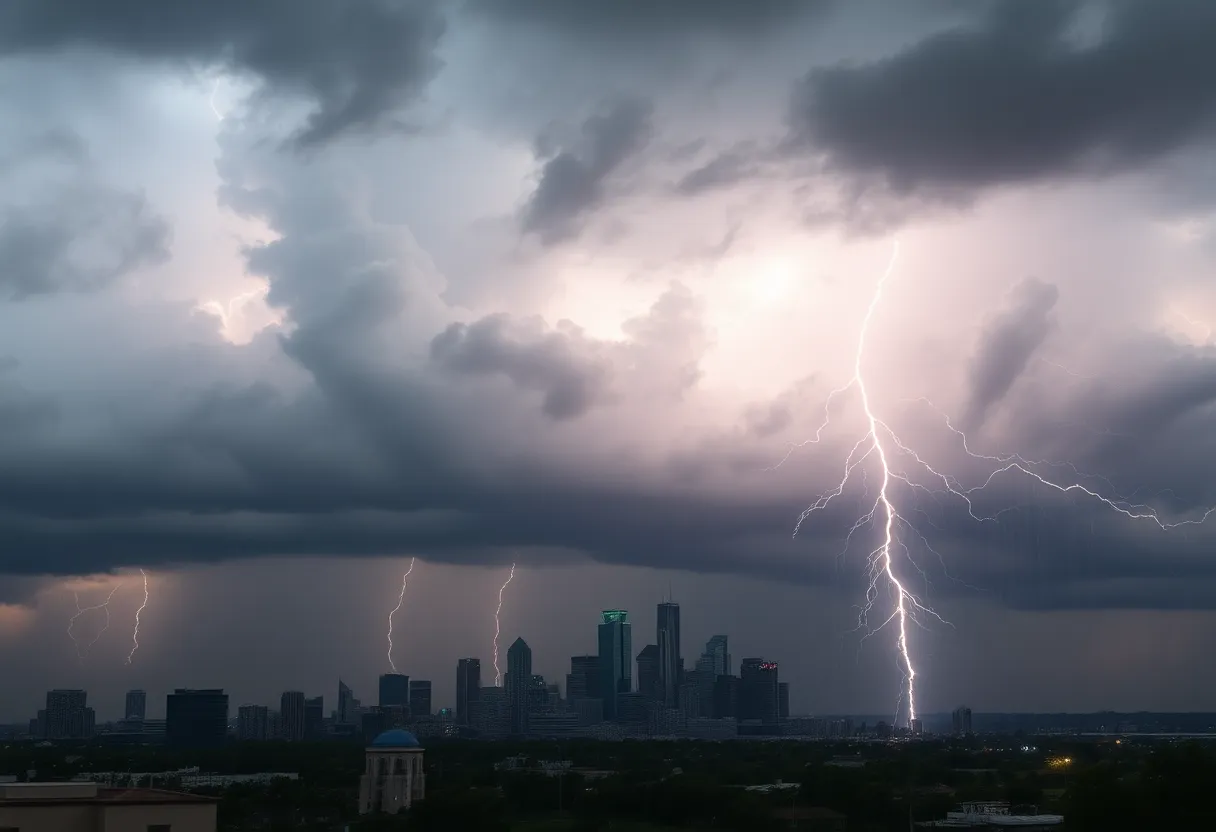
Houston is preparing for an active weather pattern on Sunday as a weak cold front moves through Southeast Texas, causing significant rainfall and increased flash flood risks. The National Weather Service has reported that deep tropical moisture will combine with this front, leading to the formation of scattered thunderstorms across the region.
The expected thunderstorms pose a risk of isolated flooding, and this system may serve as Houston’s last significant opportunity for rainfall for an extended period. Weather forecasts indicate that sunny and dry conditions will resume later in the week, bringing rising temperatures back into the forecast.
Weather Forecast Overview
Sunday morning will begin under mostly cloudy skies, with temperatures ranging from the mid- to upper 70s. Rain chances are relatively low during this time, with probabilities around 30% or less. A few isolated showers and weak storms may occur before midday.
Peak rain chances are expected between 10 a.m. and 4 p.m., when the likelihood of rainfall increases to approximately 50-60%. Thunderstorms are predicted to intensify as they move southward into the Houston metropolitan area. While many regions may receive less than half an inch of rain, stronger storms could lead to intense rainfall rates, reaching 2-3 inches per hour.
Flooding Risks
A low risk of flooding exists across Southeast Texas on Sunday, with the area designated under a Level 1 of 4 risk for excessive rainfall. This classification indicates a 5% chance of flash flooding occurring within a 25-mile radius, so residents should remain vigilant, especially in areas prone to flooding.
Afternoon temperatures will rise into the mid- to upper 80s due to increased moisture and cloud cover. As evening approaches, rain chances will diminish significantly, with rainfall likely shifting toward southern areas, including Victoria and the Rio Grande Valley. After sunset, Houston’s temperatures are expected to fall into the 70s, providing a brief respite from the heat.
Upcoming Weather Changes
The new work week will usher in a shift in weather patterns as high pressure builds in the region. Starting Monday, sunny weather and drier air will dominate, with high temperatures projected to tend toward the 90s. While lingering showers may be possible, rain chances are expected to decrease significantly to around 20% or less, with temperatures rising near the 90-degree mark.
On Tuesday and Wednesday, the forecast predicts continued dry conditions, with morning lows dropping to the upper 60s to low 70s and daytime highs near the low 90s. This trend of dry weather is anticipated to persist through the end of the week and into the following weekend.
Experts suggest that the next chance for widespread rainfall is not expected until the mid-September timeframe, specifically between September 15 and 18. As a result, the residents of Houston may soon experience a break from the region’s intense humidity.
Tropical Weather Update
In terms of tropical weather, the Gulf remains generally quiet, with no significant threats anticipated at this time. Residents are encouraged to stay informed and prepared for the upcoming thunderstorms while also looking forward to the favorable weather conditions that are expected to follow.
Deeper Dive: News & Info About This Topic
HERE Resources
University of Houston Soccer Secures Historic 8-0 Victory
Vallejo School District Plans More Closures and Consolidations
Southeast Texas Braces for Thunderstorms and Flood Risks
Houston Prepares for a Vibrant Labor Day Weekend
High School Football Season Begins in Houston Metro Area
Houston Soccer Game Against Sam Houston State Canceled
Kyrene de la Sierra Elementary School Remains Closed
Houston Prepares for Heat and Thunderstorms This Week
Houston Dynamo 2 Claims Victory Over Sporting Kansas City II
Tropical Update: Invest 98 Strengthens and Storm Erin Intensifies
Additional Resources
- Houston Chronicle
- Click2Houston
- Fox 26 Houston
- Google Search: Houston Weather Forecast
- Encyclopedia Britannica: Weather

Author: STAFF HERE HOUSTON TX WRITER
The HOUSTON STAFF WRITER represents the experienced team at HEREHouston.com, your go-to source for actionable local news and information in Houston, Harris County, and beyond. Specializing in "news you can use," we cover essential topics like product reviews for personal and business needs, local business directories, politics, real estate trends, neighborhood insights, and state news affecting the area—with deep expertise drawn from years of dedicated reporting and strong community input, including local press releases and business updates. We deliver top reporting on high-value events such as Houston Livestock Show and Rodeo, Art Car Parade, and Chevron Houston Marathon. Our coverage extends to key organizations like the Greater Houston Partnership and Houston Area Urban League, plus leading businesses in energy and healthcare that power the local economy such as ExxonMobil, Schlumberger, and Houston Methodist. As part of the broader HERE network, including HEREAustinTX.com, HERECollegeStation.com, HEREDallas.com, and HERESanAntonio.com, we provide comprehensive, credible insights into Texas's dynamic landscape.