
News Summary
Residents across Southeast Texas, including Houston, are preparing for severe thunderstorms on May 2, 2025. The National Weather Service has issued an enhanced risk for severe weather, with thunderstorms predicted to bring strong winds, large hail, and heavy rainfall. A Stage 1 flood alert has been issued, urging residents to stay informed and secure loose outdoor items. While a brief period of calm is expected after the storms, more severe weather is anticipated over the weekend. Residents are advised to continuously monitor alerts as conditions may rapidly change.
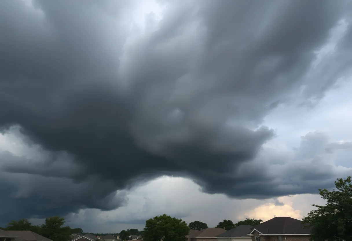
Houston, Texas – Residents in Southeast Texas and the Houston area are bracing for strong to severe thunderstorms on the afternoon and evening of May 2, 2025. The National Weather Service has issued an enhanced risk (level 3 out of 5) for severe weather, particularly impacting areas north of Interstate 10, as a powerful line of storms is anticipated to sweep through the region.
The thunderstorms are expected to begin developing shortly after lunchtime, with morning hours remaining calm. However, meteorologists warn that conditions will shift rapidly by mid-afternoon due to increasing atmospheric instability in the metro area. Storms are projected to bring dangerous winds exceeding 40-50 mph, the potential for large hail, and localized flooding.
Heavy rain is also forecasted, with total rainfall amounts potentially reaching 3 to 4 inches in some areas. A Stage 1 flood alert has been issued as a precaution, especially for low-lying and flood-prone neighborhoods. Residents are urged to stay aware of weather updates, secure any loose outdoor items, and establish multiple methods for receiving alerts on changing conditions.
Following this severe weather event, a period of quiet and possibly pleasant weather is anticipated for the weekend. However, another window for severe storms is expected on Saturday afternoon into the evening (2 p.m. to 11 p.m.) as a cold front approaches. This line of storms could bring isolated thunderstorms capable of producing tornadoes along with damaging winds and large hail measuring between 1 to 2 inches in diameter.
Wind speeds associated with these storms may range from 58 to 74 mph, and atmospheric instability caused by wind shear related to the cold front heightens the risk for severe weather. Residents are encouraged to continuously monitor weather alerts throughout the weekend, particularly for the Saturday forecast, as some showers and thunderstorms may persist southwest of Houston, particularly toward Matagorda Bay.
Looking ahead to next week, an active weather pattern is expected from Tuesday to Thursday, bringing additional threats of severe weather and flash flooding. As the timeframe for these storms approaches, residents are advised to stay vigilant and informed about potential weather-related hazards.
In summary, Southeast Texas is preparing for a significant weather event with strong storms, high winds, and potential flooding. By staying informed and taking necessary precautions, residents can help ensure their safety during this tumultuous weather period.
Deeper Dive: News & Info About This Topic
HERE Resources
Houston Transforms into Entertainment Hub This Weekend
Tornado Watch Issued for Northern Houston Areas
Houston Prepares for Wet Weather and Thunderstorms
Severe Thunderstorm Warning Issued for West and Southeast Texas
Houston Faces Post-Hurricane Flooding: Tropical Storm Beryl’s Impact
Houston’s Water Bills Set for Significant Increase
Severe Thunderstorms Cause Widespread Power Outages in Houston
Houston Weather Update: Cold Front Brings Showers for Easter
Chaos Unfolds for Nearly 300 Delta Passengers Stranded Overnight
Nearly 300 Delta Passengers Stranded Overnight on Tarmac
Additional Resources
- Chronicle: Houston, Texas Storms
- Wikipedia: Severe Weather
- Chronicle: Thursday Forecast
- Google Search: Houston Weather Forecast
- 12News Now: Weekend Events Rescheduled
- Google Scholar: Severe Weather Impact
- Chronicle: Wednesday Storms
- Encyclopedia Britannica: Weather Forecasting

Author: STAFF HERE HOUSTON TX WRITER
The HOUSTON STAFF WRITER represents the experienced team at HEREHouston.com, your go-to source for actionable local news and information in Houston, Harris County, and beyond. Specializing in "news you can use," we cover essential topics like product reviews for personal and business needs, local business directories, politics, real estate trends, neighborhood insights, and state news affecting the area—with deep expertise drawn from years of dedicated reporting and strong community input, including local press releases and business updates. We deliver top reporting on high-value events such as Houston Livestock Show and Rodeo, Art Car Parade, and Chevron Houston Marathon. Our coverage extends to key organizations like the Greater Houston Partnership and Houston Area Urban League, plus leading businesses in energy and healthcare that power the local economy such as ExxonMobil, Schlumberger, and Houston Methodist. As part of the broader HERE network, including HEREAustinTX.com, HERECollegeStation.com, HEREDallas.com, and HERESanAntonio.com, we provide comprehensive, credible insights into Texas's dynamic landscape.