
News Summary
Houston is under a Flood Watch due to severe thunderstorms and heavy rainfall, with expected totals of 2 to 4 inches. Commuters are facing hazardous conditions, and city officials are taking precautions to monitor potential flooding. Storms are anticipated to move out by late afternoon, but residents are advised to remain vigilant and adjust travel plans. The intense weather has already impacted traffic, creating messy road conditions. City agencies are prepared to mitigate flood risks and ensure public safety as the situation evolves.
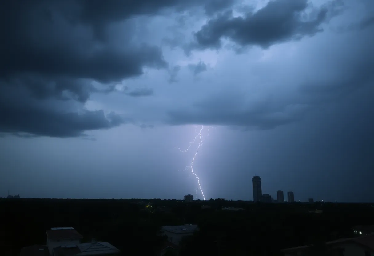
Houston Faces Severe Thunderstorm Threat with Flood Watch in Effect Until 7 PM
Houston is currently experiencing severe thunderstorms and heavy downpours, creating hazardous conditions for commuters on this Thursday morning. A Flood Watch is in effect for northern and northwestern Houston until 7 PM, with expected rain totals of 2 to 4 inches in many areas. Isolated regions may see up to 6 inches, raising concerns about street flooding and potential damage from hail and strong winds.
The storms are anticipated to move out of the area by late afternoon. However, as of now, high water conditions have been reported on FM 1960 between Huffman and Eastgate in northeast Harris County. City officials are closely monitoring specific intersections and underpasses, which may be barricaded if flooding occurs. To address the increasing risk, flood signals will be activated in the most vulnerable areas if heavy rain impacts those regions.
Meteorologists are warning residents about the possibilities of flash flooding in the strongest storms. The storm system is expected to reach the western half of the Houston metro area around sunrise or shortly thereafter. Following the initial isolated showers and thunderstorms, a significant line of storms is predicted to sweep through the city between 8 AM and noon.
The overall forecast suggests that some areas may accumulate between 1 to 4 inches of rain, while localized amounts could peak at 5 to 8 inches. As the situation develops, residents are advised to plan their travel routes ahead of time and remain vigilant of weather updates to avoid disruptions during the morning commute.
Current Conditions and Precautions
As Houston faces these severe weather conditions, it is essential for residents to stay informed about the risks associated with heavy rainfall and thunderstorms. The Flood Watch indicates that conditions are ripe for potential flooding, particularly in areas where drainage systems may become overwhelmed. Roads may quickly become impassable, leading to dangerous driving conditions.
City officials have identified specific locations that are at greater risk, and residents should remain aware of these areas to ensure safety. The implementation of flood signals in at-risk neighborhoods will serve as a prompt for residents to take necessary precautions. Those living in flood-prone areas are encouraged to stay indoors during the storm and avoid traveling unless absolutely necessary.
Impact on Commuters
The ongoing severe weather is already having an impact on the Thursday morning commute, with reports of messy traffic conditions due to the rain. Commuters are reminded to exercise caution when driving, as wet roads increase the chance of accidents. Authorities advise drivers to remain attentive and adjust their speed accordingly to account for potentially slick conditions.
Background Information
This storm system is part of a broader trend of severe weather events affecting the Houston area. Thunderstorms are not uncommon in this region during this time of year, yet the scale of this particular system raises concerns about safety and infrastructure. Local government agencies are actively working to prepare for the impacts of severe weather, implementing plans to mitigate flood risks and ensure the safety of residents.
As the storm progresses throughout the day, residents should continue to monitor updates from meteorological sources and city officials. Preparedness is key in navigating the challenges posed by severe weather in Houston, especially during heavy rainfall and thunderstorms.
Deeper Dive: News & Info About This Topic
HERE Resources
Houston Experiences Severe Thunderstorms Leading to Flooding and Travel Disruptions
Southeast Texas Bracing for Severe Thunderstorms and Flooding Risks
Texas Homeowners Face Rising Insurance Denials Amid Storms
Houston Faces Severe Weather Alert Impacting Commute
Hazy and Hot Weekend Ahead for Houston
Houston Braces for Extreme Heat This Weekend
Houston Faces Severe Street Flooding Amid Urgent Need for Drainage Improvements
Houston Prepares for Hot and Hazy Summer
Severe Thunderstorm Watch Issued in Southeast Texas
Houston Bracing for Severe Weather as Cold Front Approaches
Additional Resources
- Click2Houston: Live Radar Strong Thunderstorms
- Wikipedia: Thunderstorm
- KHOU: Weather Impact Alert Live Update
- Google Search: Severe weather Houston
- Space City Weather: Strong Storms Likely
- Google Scholar: Houston flood risk
- Click2Houston: High Water Spots to Avoid
- Encyclopedia Britannica: Flooding
- Fox26 Houston: Storm Alert
- Google News: Houston severe weather