
News Summary
Houston is currently facing a flash flood warning due to severe thunderstorms, with rain rates of 2 to 4 inches per hour. As thunderstorms move eastward, residents are urged to exercise caution. A tragic incident has resulted in the death of a 10-year-old girl due to flooding. The storm activity is expected to continue affecting Southeast Texas and other regions, impacting millions.
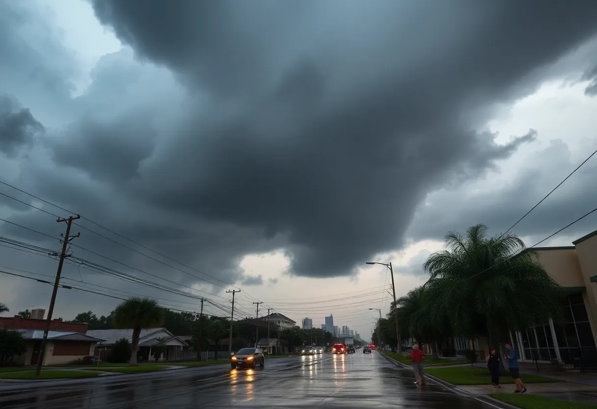
Houston is currently under a flash flood warning due to severe thunderstorms affecting the region. As of 10:30 PM CT, meteorologists have reported a stationary line of thunderstorms impacting the Highway 59 corridor, leading to rapidly developing flooding issues. The flash flood warning is in effect until midnight as rain rates between 2 to 4 inches per hour are being measured during the heaviest downpours. Residents and drivers in the affected areas are urged to exercise caution as conditions are worsening.
Forecasts indicate that the thunderstorms may persist in the Houston area until between 12 AM and 2 AM before moving eastwards towards the Texas coast, which is expected to aide in the exiting of the storms. However, the situation has developed unexpectedly, resulting in some areas experiencing intense thunderstorms while others remain dry, creating a confusing weather experience for local residents.
A flood watch remains in effect for parts of Southeast Texas through Tuesday, with rainfall totals anticipated to reach 6 inches or more over the next few days. On Tuesday morning, mainly light showers are expected. However, as the day progresses, more severe storms may build, potentially affecting travelers heading to Austin or San Antonio between 7 AM and 11 AM. Afternoon storms across Southeast Texas could yield large hail over 2 inches and damaging winds of up to 60 mph. There is also a possibility of a stray tornado amid these severe weather conditions.
As of now, areas near and north of Lake Livingston are under a level 2 out of 4 risk for flash flooding. Rainfall estimates across Southeast Texas generally range from 1 to 3 inches, with higher totals possible in specific areas. Storms on Tuesday afternoon are expected to move eastward into Louisiana by the evening drive, with scattered downpours lingering into the night. Additional rounds of thunderstorms may follow Tuesday evening, especially south of I-10, depending on preceding activity. Rainfall on Tuesday night into Wednesday could further contribute 2 to 4 inches of rain.
Tragically, a recent incident highlights the severe impact of these weather conditions: an unfortunate event resulted in the confirmed death of a 10-year-old girl in Brenham, Texas, due to flooding caused by rapid rainfall. A community search effort was organized to find her, but efforts were unsuccessful amidst the harsh weather conditions.
This severe weather pattern has prompted flood watches across other regions as well, including widespread areas of Louisiana and parts of Texas, Arkansas, and Mississippi, impacting over 8 million people. Heavy rainfall is projected to extend into the Southeastern U.S., with some areas expecting up to 8 inches of rain. Furthermore, parts of northeastern Pennsylvania, northwestern New Jersey, and southern New York are also bracing for increased storm activity and heavy rainfall.
Overall, significant storm activity is anticipated throughout the region in the upcoming days, attributed to an unsettled weather pattern. All residents are advised to stay informed and prepared as conditions may change rapidly.
Deeper Dive: News & Info About This Topic
HERE Resources
Houston Prepares for Severe Weather as Flood Alerts are Issued
Severe Weather System Impacts Houston Area
Severe Thunderstorms Expected in Southeast Texas
Houston Prepares for Wet Weather and Thunderstorms
Severe Thunderstorm Warning Issued for West and Southeast Texas
Houston Faces Post-Hurricane Flooding: Tropical Storm Beryl’s Impact
Houston Weather Update: Cold Front Brings Showers for Easter
Weather Alert: Severe Storms Coming to Southeast Texas This Weekend
Northeast Texas Faces Severe Thunderstorm Warnings
Severe Weather Alert: High Risk for Rip Currents and Thunderstorms in Southeast Texas
Additional Resources
- Houston Chronicle
- Wikipedia: Flash Flood
- Space City Weather
- Google Search: Severe Weather Houston
- Click2Houston
- Google Scholar: Severe Weather Impact
- USA Today
- Encyclopedia Britannica: Severe Weather
- New York Times
- Google News: Texas Flooding