
News Summary
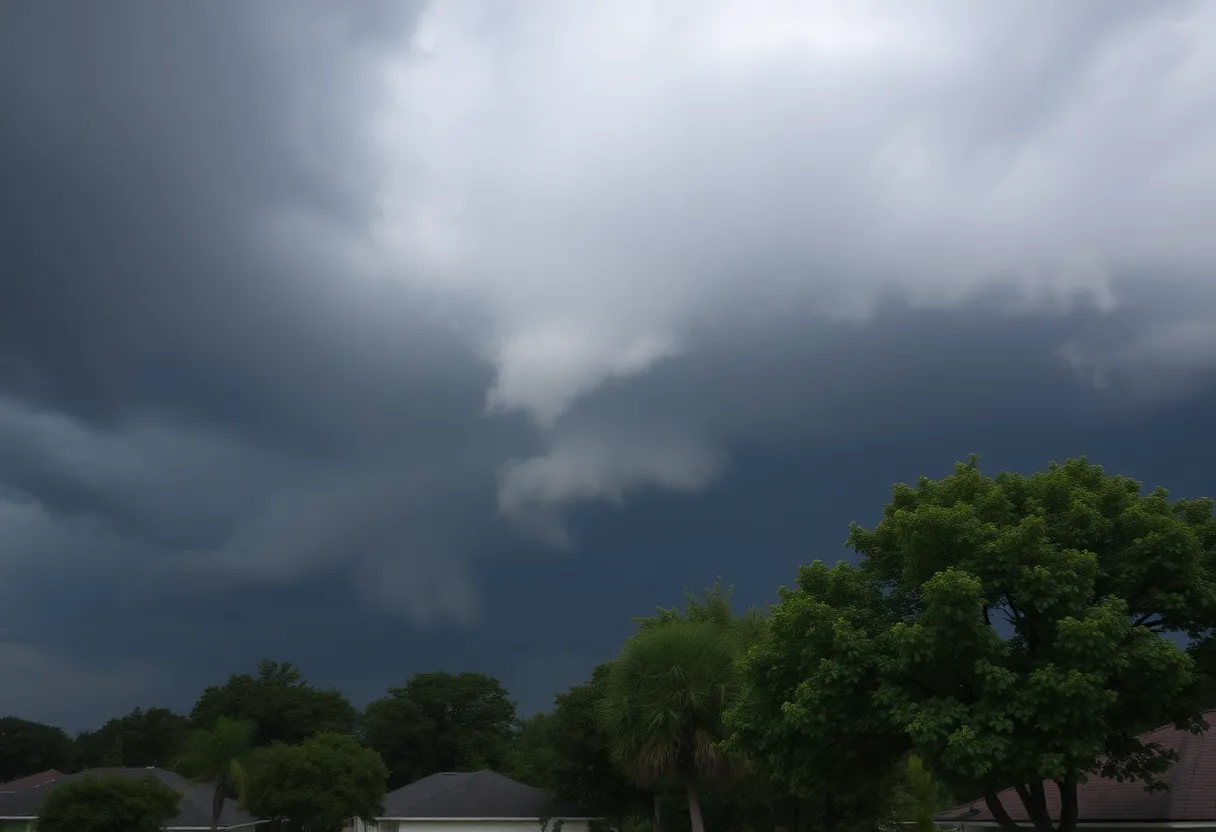
A tornado watch is in effect for multiple counties north of Houston until 8 PM Wednesday. The National Weather Service warns of potentially severe thunderstorms capable of producing tornadoes, large hail, and damaging winds. Residents are urged to prepare for severe weather and take necessary safety precautions, especially if a tornado warning is issued. The storms are expected to progress southward, with heightened activity anticipated between Bryan and College Station, potentially impacting the Houston area overnight.
Houston – A tornado watch has been issued for multiple counties north of Houston, effective until 8 PM on Wednesday. This significant weather advisory covers a wide range of areas including Anderson, Angelina, Bell, Brazos, Burleson, Cherokee, Ellis, Falls, Freestone, Grimes, Henderson, Hill, Houston, Leon, Limestone, Madison, McLennan, Milam, Nacogdoches, Navarro, Panola, Robertson, Rusk, Sabine, San Augustine, Shelby, Trinity, Walker, and Washington counties.
The National Weather Service has indicated that conditions are particularly favorable for the development of strong storms capable of producing tornadoes, along with large hail and damaging winds. Current forecasts indicate that strong thunderstorms are forming between the Dallas-Fort Worth metroplex and College Station, prompting heightened concern for residents in these areas.
Residents in the tornado watch zone are urged to prepare for severe weather and to be ready to seek shelter immediately if a tornado warning is issued. The safest places to take cover during a tornado include a basement, storm shelter, or an interior closet located on the lowest level of a building. Additionally, for added protection, it is advised to grab a bike helmet or pillows to shield against debris.
If individuals find themselves in a vehicle when a tornado warning is issued, they should seek shelter in a sturdy building nearby. If such a location is not accessible, remaining in the car with seatbelts fastened and heads protected is advised until the storm passes.
A broken line of intense storms is anticipated to move towards Bryan and College Station between 8 PM and 10 PM, with Huntsville and Conroe bracing for storms between 9 PM and 11 PM. As these storms progress southward, a weakening line is expected to approach the Houston area overnight, reaching early Thursday morning. However, rain in Greater Houston is not expected until after midnight. The anticipated arrival times for storms are between 1 AM and 2 AM for northern Harris County, and 2 AM to 4 AM for central and southern Harris County.
While the severity of the storms is projected to lessen as they move towards Houston, residents are urged to remain vigilant and monitor potential warnings. Continued chances for storms are predicted in the Houston area through Thursday, Friday, and Saturday, although the most intense weather is likely to remain focused north of Houston.
In summary, it is critical for residents in the affected areas to stay well-informed and prepared for inclement weather. Regular updates and monitoring of local weather reports can help individuals respond effectively to any developments as conditions evolve.
Deeper Dive: News & Info About This Topic
HERE Resources
Severe Thunderstorm Warning Issued for West and Southeast Texas
Weather Alert: Severe Storms Coming to Southeast Texas This Weekend
Severe Weather Alert: High Risk for Rip Currents and Thunderstorms in Southeast Texas
Severe Weather Hits Houston and the Rio Grande Valley
Houston Lawyer Eric Dick Arrested in Spousal Assault Incident
Additional Resources
- Fox 26 Houston
- Wikipedia: Tornado
- Click2Houston
- Google Search: tornado watch Houston
- Houston Chronicle
- Google Scholar: tornado weather hurricane
- KIMT News
- Encyclopedia Britannica: Tornado
- Fox 26 Houston Video
- Google News: Houston weather news